In anticipation of some interesting results, I’ve been accumulating data on a constituency basis to be ready to do some analysis of the results of the UK general election on the 7th May. I’m also playing with the current maps – how best to cope with shifting electoral boundaries.
I’ve deliberately avoided commenting on the polls here – as I would prefer that this remain as apolitical as possible. My thoughts on current polls are they are generally too broad – not capturing the local tactical voting that happens with first past the post systems. Lord Ashcroft’s polls have been interesting as they have been done on a constituency basis; the great unknown is how much these polls may influence tactical voting within marginal seats.
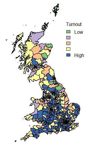
The data has been tidied up sufficiently to produce turnout maps from the previous general election – the purpose of this was really to set up all the matching rules for how different organisations name constituencies. It’s a surprising amount of faff – why couldn’t everyone work with the ONS codes (or at least include them in the datasets for easy matching!)?
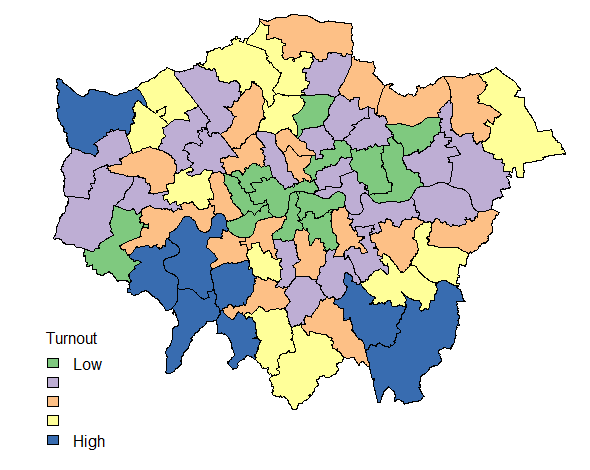
I’ve also worked out the niceties of “zooming in” for dense areas that are difficult to see on a national map with London used as an example.
So I think that I’m ready to go for analysis of the election results next week! Results should be interesting.
